
Since today (October 14th) is Indigenous People’s Day, here’s a look at a walking tour exploring the highlights and history of indigenous peoples in DC.
Many towns and states across the U.S. now celebrate Indigenous People’s Day (instead of Columbus Day).
Include DC on that list. The DC city council held an emergency vote to officially celebrate it for 2019.
One way to honor the indigenous peoples of our country is to take the walking tour outlined in the Guide to Indigenous DC, which can be downloaded as an app. The Guide was developed by the AT&T Center for Indigenous Politics and Policy at the George Washington University and in partnership with the American Indian and Alaska Native Tourism Association.
The walking tour explores 17 stops across the city, from the U.S. Marine Corps War Memorial to the Congressional Cemetery, about 9 miles in total.
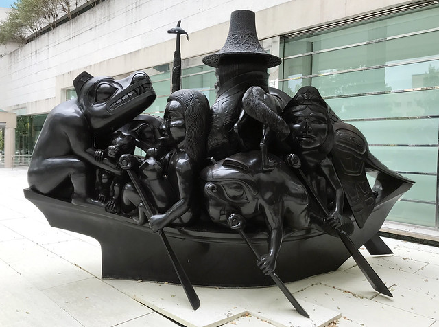
The stops have a mix of history around events or places, including the locations of protests, museums, statues, totem poles, and more. There is a lot to take in, some of the topics you will definitely want to dig deeper into after the tour. The brief descriptions for each stop have links to references and more information.
I recently joined a bike tour (using the app) on a Sunday, organized by Up Your Alley newsletter author, Michael Silliman. The newsletter speaks to the issues of affordable housing and urbanism in DC.
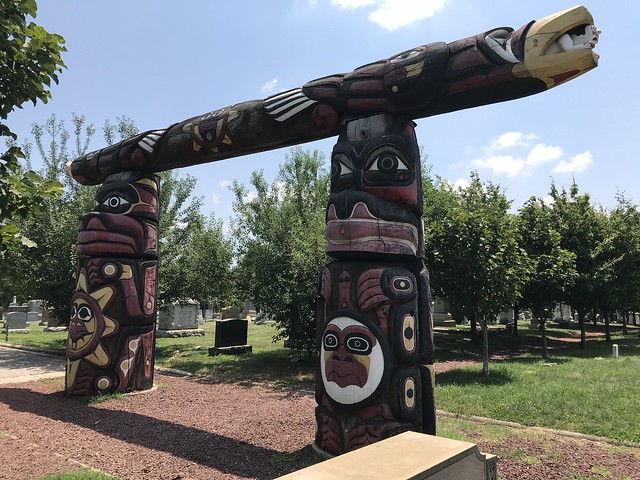
I used a Capital Bikeshare bike and didn’t have any issues with finding docking stations along the route. Note, it is designed as a walking tour, and as many of the places require you to enter buildings or areas that don’t allow bikes, you won’t see everything unless you lock up your bike. Also, a few places were closed on a Sunday (Stops 5 and 6), and some you can’t see at all (Stop 7). I had been to a few of the places before, like the Healing Totem Poles at Congressional Cemetery (Stop 16) (follow the link for a previous Deciphering DC on that topic).
We finished the bike tour in about 2-1/2 hours, but definitely would have spent more time if we could go inside all of the places.
Coolest things I learned on the tour:
- One of the men commemorated in the U.S. Marine Corps War Memorial (Stop 1) is Ira Hayes, born on the Gila River Indian Reservation in Arizona. His gravesite is at Arlington National Cemetery.
- Teddy Roosevelt Island’s (Stop 2) original name was Analostan Island, an anglicized version of the Nacotchtank people, who had lived nearby along the Anacostia River.
- Along the sides of the Dumbarton Bridge (Stop 9) there are 56 busts of Oglala Lakota leader Kicking Bear. If you look hard enough you can see some of the busts from the top (see photo).
- While searching for the resting site of the Tribal Delegates (Stop 17) at the Congressional Cemetery, we found many bee hives, which I didn’t realize were there.
Lastly, the map portion of the app isn’t as user friendly as it could be. For example, the route has you flying across the Potomac River from Highway 66 at one point and diagonally zooming across the city between Lafayette Square and Dumbarton Bridge at another. Neat tricks if you’re a drone. It does show where you need to go, so use Google Maps for some of the actual navigation between the stops.
You can use a website version here.
Find the Apple Store app preview here.


Until next time.

2 thoughts on “Deciphering DC: Guide to Indigenous DC”